Local history guide
Resources in our collection to help local historians trace the history of a place.
Tip for researchers
We hold the New South Wales government's archives collection. When searching for localities, the first step should be to determine what dealings the government of the day may have had with an area. You then need to consider which public office would be likely to have carried out the relevant government function.
Preliminary research
These sources can help you better identify possible public offices and record series that may assist you in your research.
- Printed sources such as books, newspapers and journal articles can help to establish when, how, and why a particular area was settled
- Interviewing long time residents can help, especially if little research has previously been undertaken
- Material may also be held in public libraries, local government archives, historical societies and the Mitchell Library
- Printed government sources, including Government Gazettes, Parliamentary Papers and the Blue Books (Returns of the Colony) can also provide background information.
Search the catalogue
You can search all the name & place indexes at once via the State Archives catalogue. Many indexes mention various localities and are therefore excellent sources for local history research.
The catalogue is a powerful single search tool that provides access to the 1.9 million items in the State Archives Collection and the 1.7 million online index entries in the one place. It includes contextual information that can help to identify which public office administered which government function at a particular time.
Our catalogue is a valuable tool for local history research - records are listed by series title and item title, often showing the locality name - but please note that other guides and finding aids in Subjects A-Z should also be consulted.
Sources of interest
Using indexes for local history research
This webinar shows you how to use our indexes in your local history research

Colonial Secretary
The Colonial Secretary had widespread administrative responsibilities. The Colonial Secretary's Department acted as the channel of communications between the Governor, other Government offices and private settlers. Consequently the Colonial Secretary's records are an important source for correspondence relating to alienated and leased Crown lands.
The Index to the Colonial Secretary's Papers, 1788-1825 is arranged alphabetically and by subject/locality.
Researchers should also check the index:
Subjects A-Z
Our suite of research guides, indexes and webinars is of particular value to historians and is arranged alphabetically by research topic.
Some of the subjects of interest to local historians are listed below along with relevant guides and indexes to search.


Crown land records
We hold information on the original alienation and occupation of Crown land.
Surveyor General
The Surveyor General was responsible for exploring and surveying New South Wales and the alienation of Crown Land.
See more about the Surveyor General in the catalogue (Agency No. 1773).
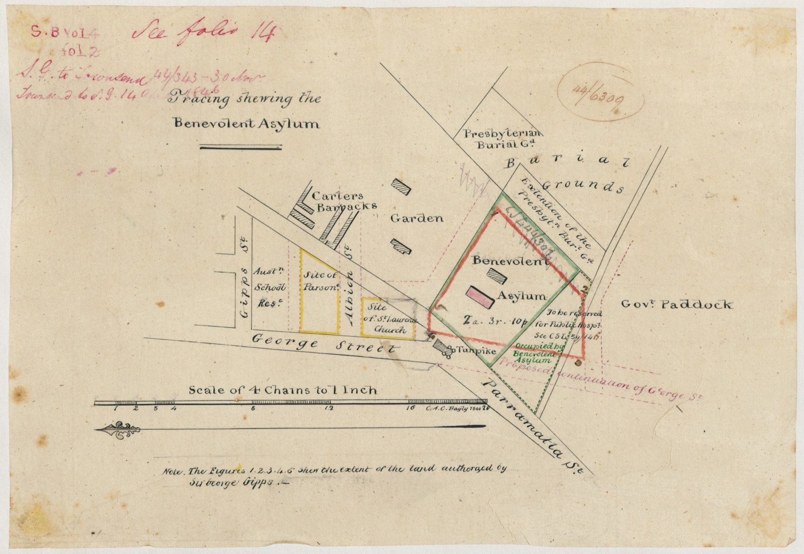
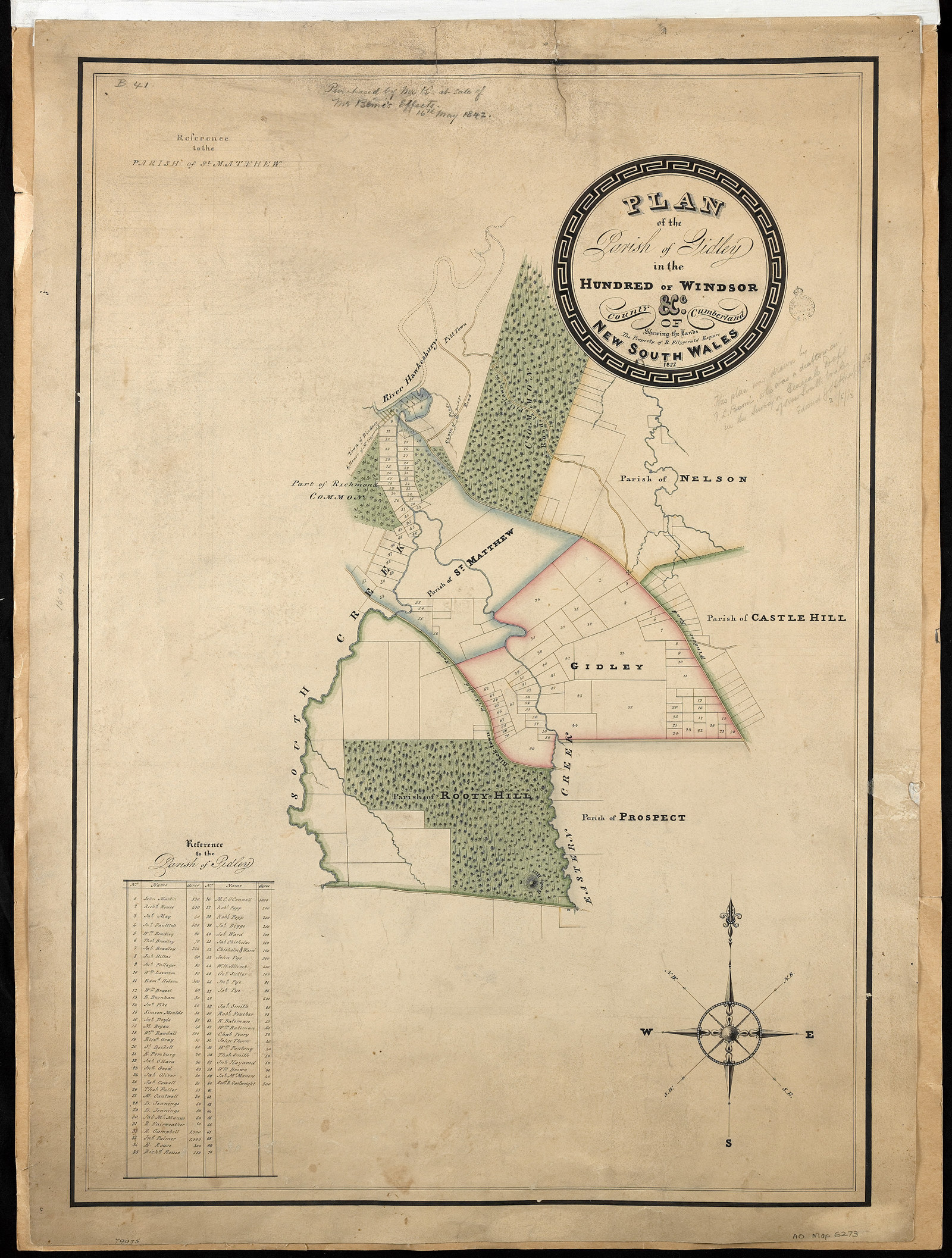
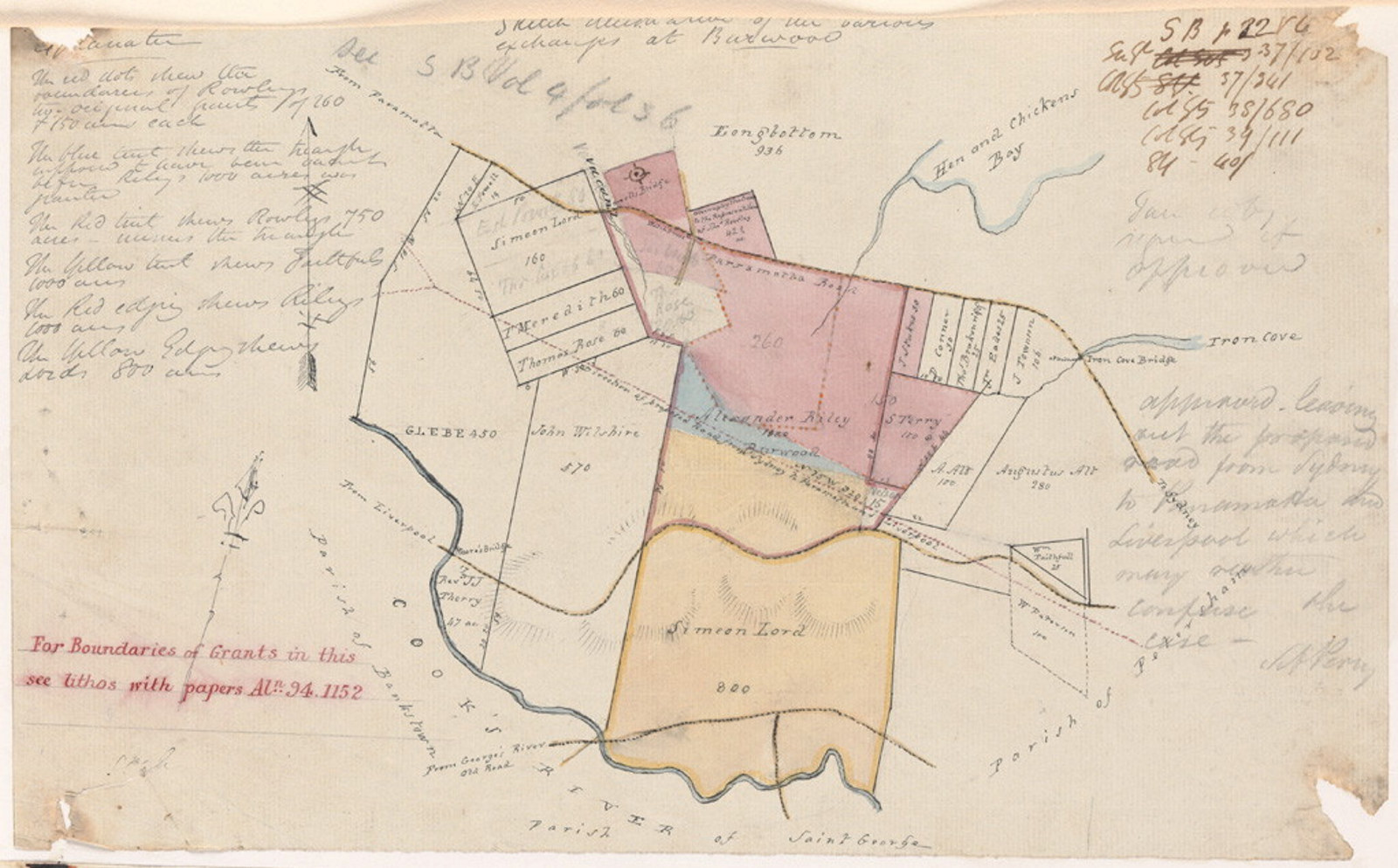
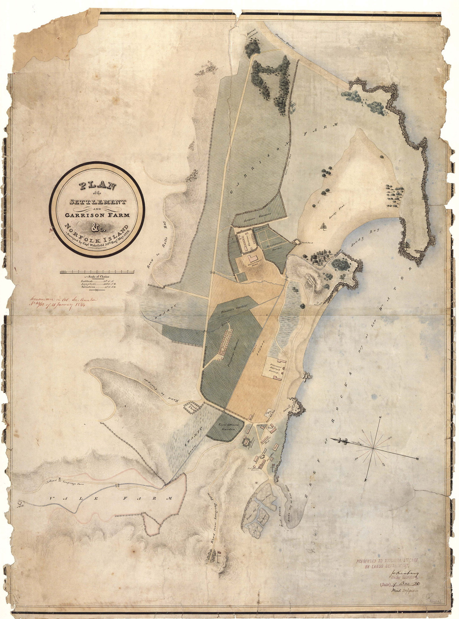
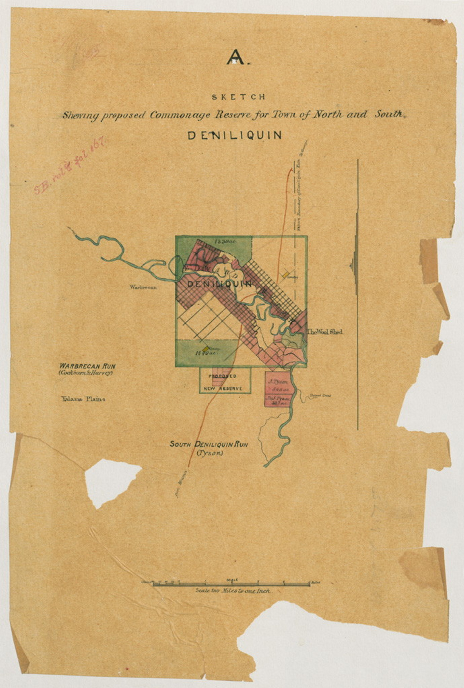
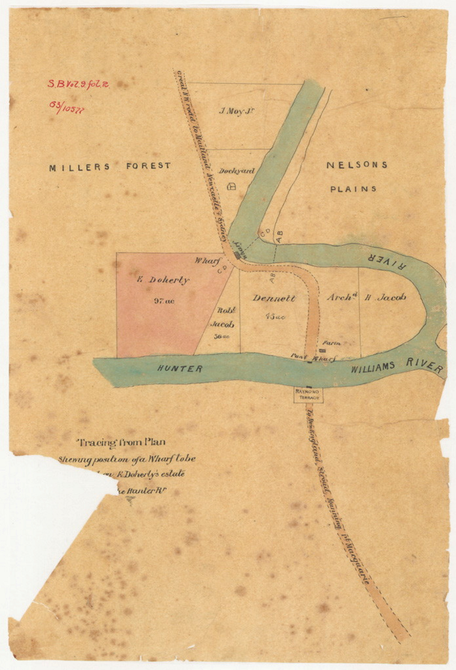
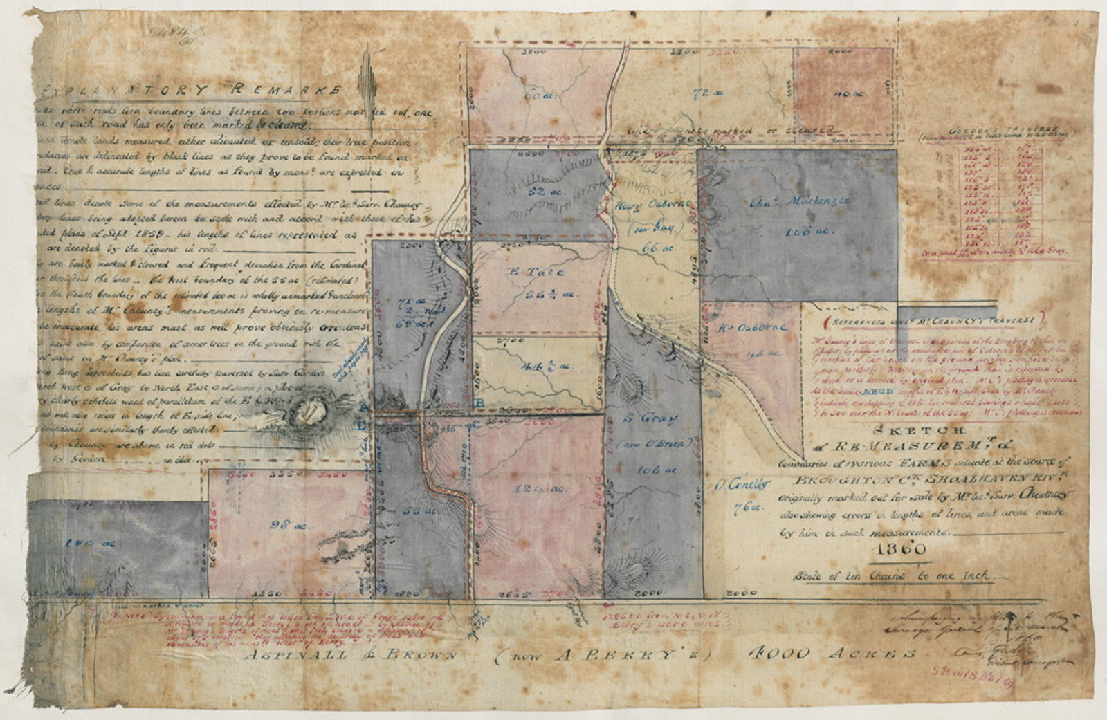
Maps
We have a large collection of original surveys, maps and crown plans of areas in New South Wales. See the Index to Surveyor General's Crown Plans 1792-1886. Also consult the Index to Maps and Plans in the Reading Room.
Field books
The records of the Surveyor General include Surveyors field books are searchable in the Index to Surveyors' field books, 1794-1860.
Surveyor General guide
These cartographic records provide detailed descriptions of the nature, agricultural potential & occupancy of land in the colony

Surveyor General's crown plans 1792-1886
5,400+ entries of the earliest surveys of NSW: towns & villages, squatting districts, counties & parishes, roads, rivers, mountain ranges & explorers' expeditions

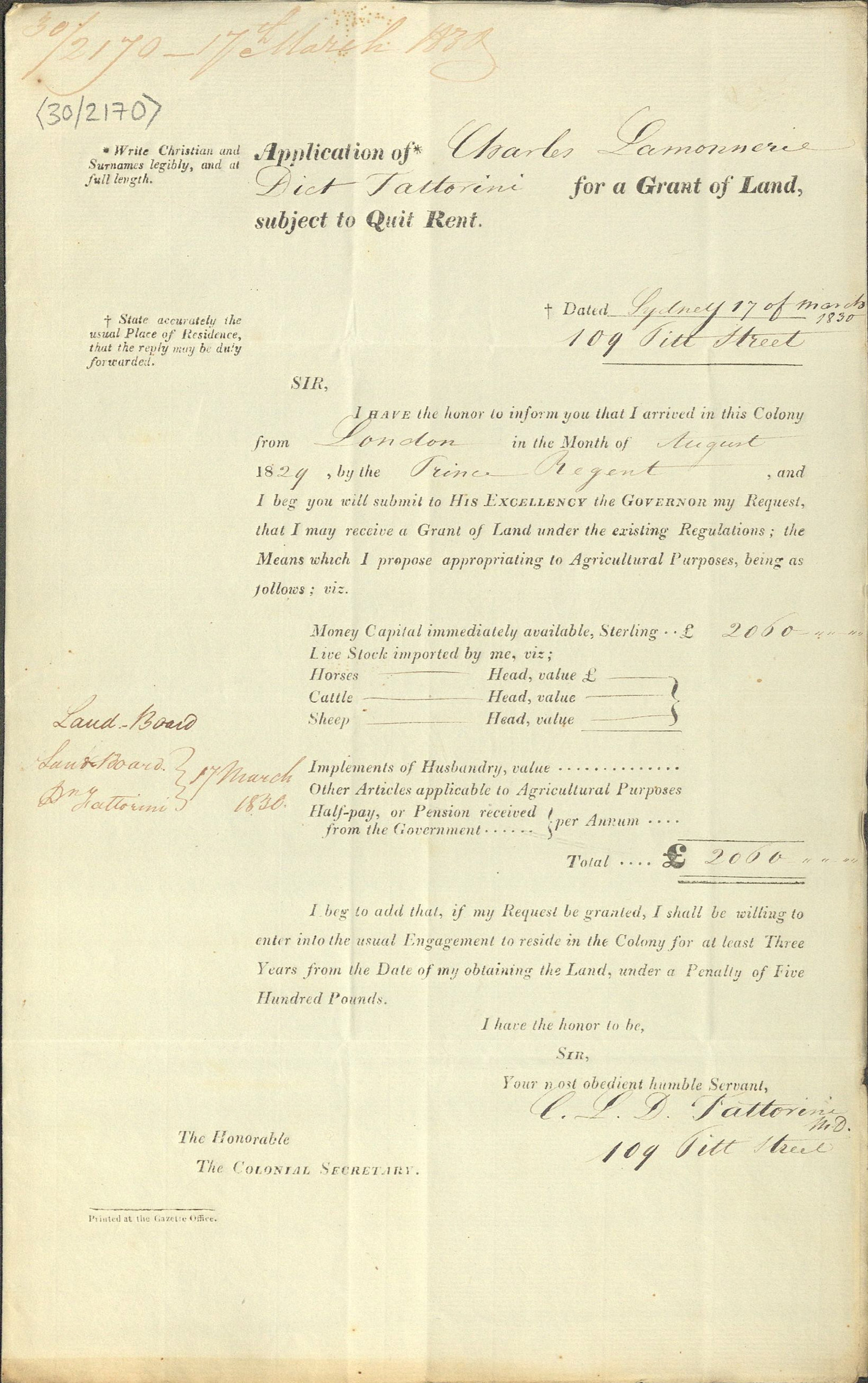
Land grants & leases
For land grants and purchases, consult the registers of land grants and leases, listed in our catalogue and the Land grants guide, 1788-1856.
Land grants guide, 1788-1856
These records relate to the original alienation of land from the Crown. Parish maps are useful for research in this area, as they record original grants
Land grants and leases (registers) 1792-1865
An index of the first six volumes [7/445, 7/447-451] and contains all grants to 1819, mainland grants to 1822 and Cumberland grants, 1823-65
County & parish maps guide
An overview of county, parish and town/village maps created by the Department of Lands and its predecessors
NSW Land Registry Services (HLRV)
NSW Land Registry Services maintains records on the transfer of land ownership in NSW. Historical maps, plans, titles and indexes can be searched on Historical Land Records Viewer (HLRV).
Lands Department records
The Lands Department was responsible for the alienation and occupation of Crown Lands from 1859. Common forms of occupation included:
- conditional purchase
- conditional lease
- pastoral holdings, and
- occupation licences.
See our catalogue for records of the Lands Department and Western Lands Commission and the interim Guide to Occupation of Crown lands in the Reading Room.

Crown lands occupation guide
Sources relating to the occupation of Crown lands in the period prior to 1856
Commissioners of Crown Lands guide
A brief overview of the major sources and key related series we hold that relate to the Commissioners of Crown Lands
Conditional purchase of crown land guide
This Guide provides an historical background on the conditional purchase scheme in NSW from 1862 to 1951, also known as 'free selection before survey' along with a list of the major record series and step-by-step guidance on how to access them
Public building records
Buildings
For information concerning the planning and erection of public buildings check the:
- Government (Colonial) Architect Guide
- our catalogue for records of the Colonial Secretary, Government Architect and Public Works
- NRS 12419: Public Works special bundle listings
Safety Inspections
For safety inspections of theatres, public halls, shops, factories and public buildings, see our catalogue for records of the Board of Fire Commissioners.
History
We hold photographs, maps and plans that may also help to document the history of buildings. See:
- our catalogue
- the card index to maps and plans in the reading room
Parliamentary Papers may also be of interest.
Colonial (Government) Architect guide
The Colonial Architect's Department was responsible for the planning & supervision of the construction & repair of public buildings
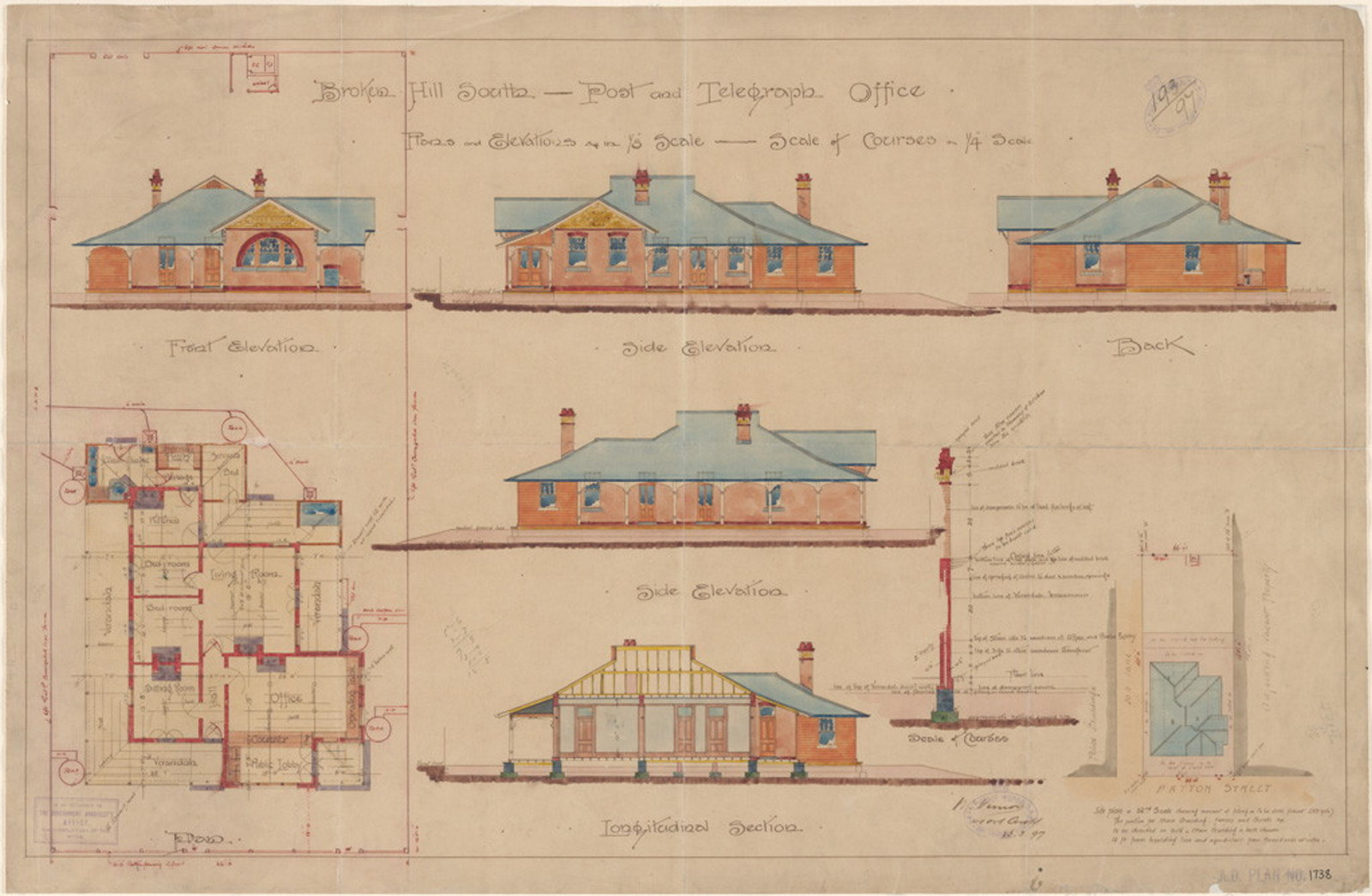
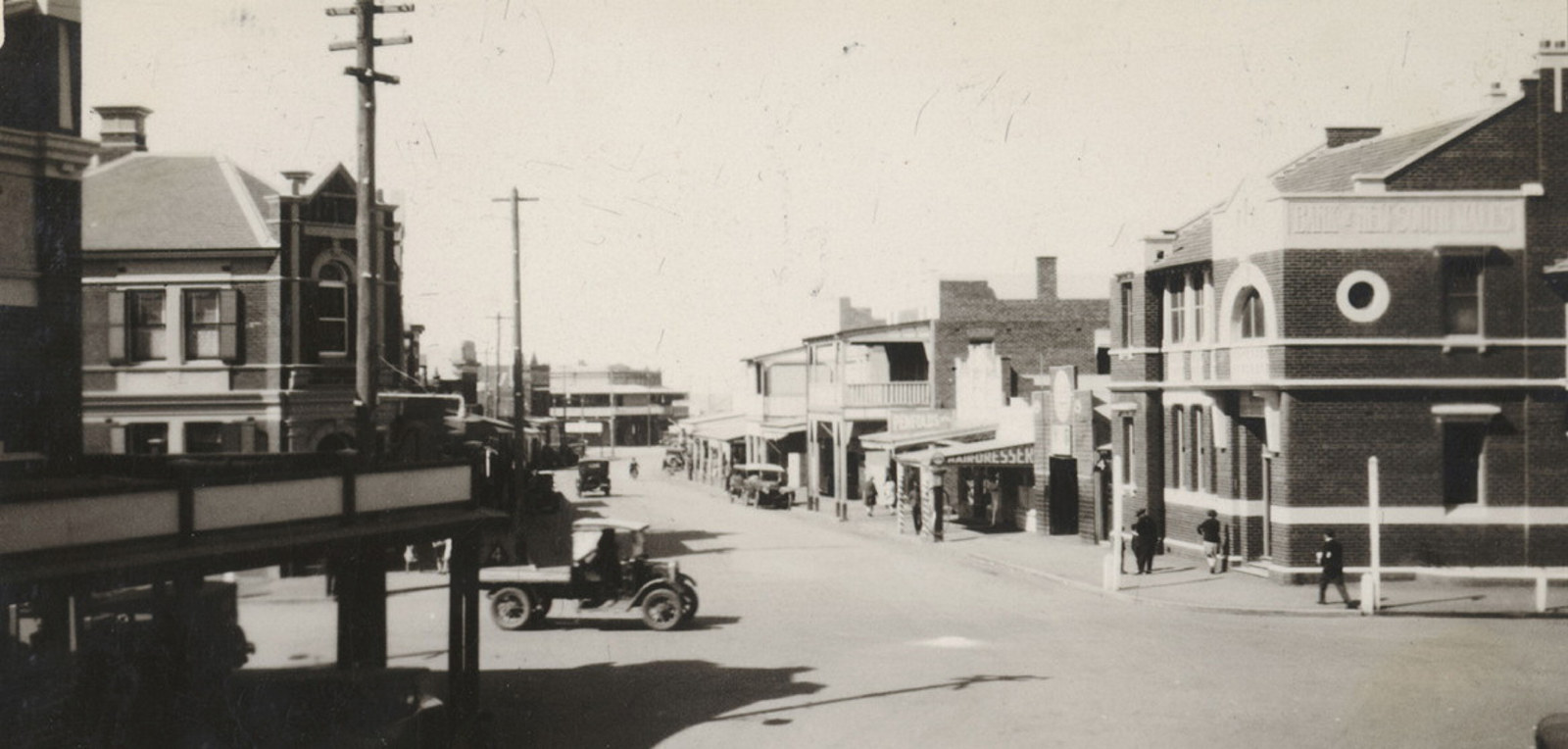
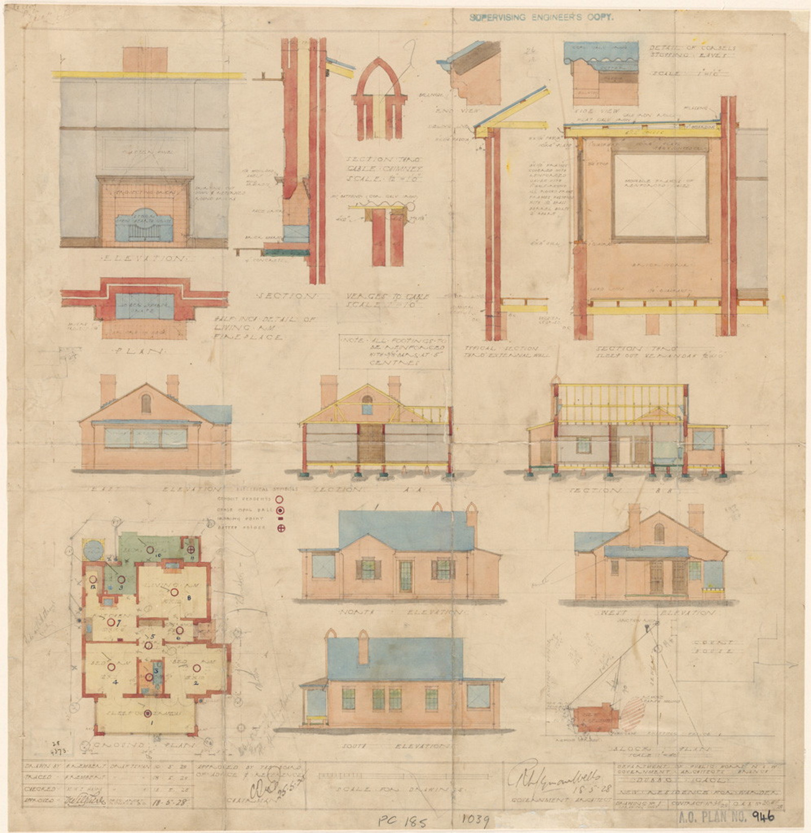
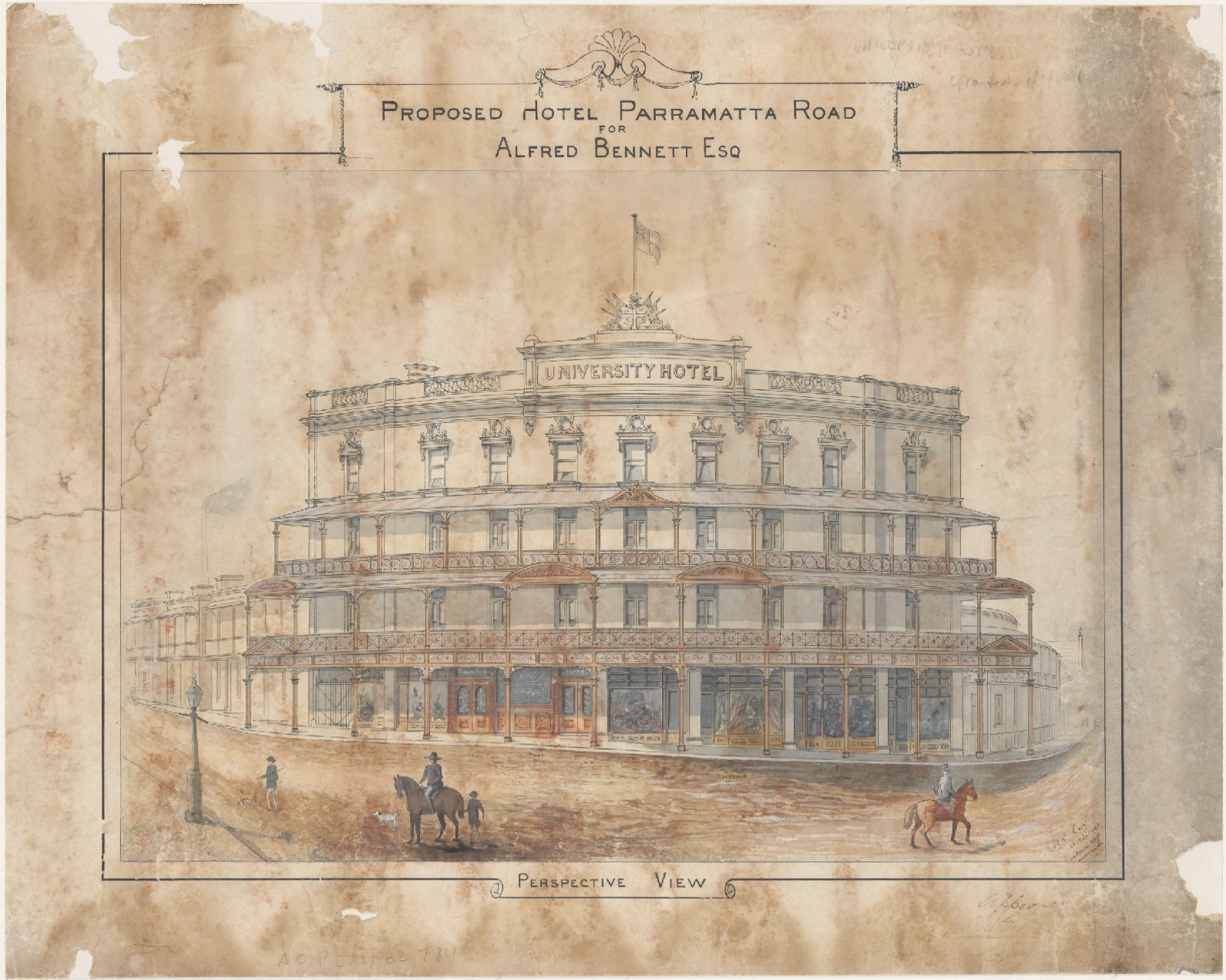
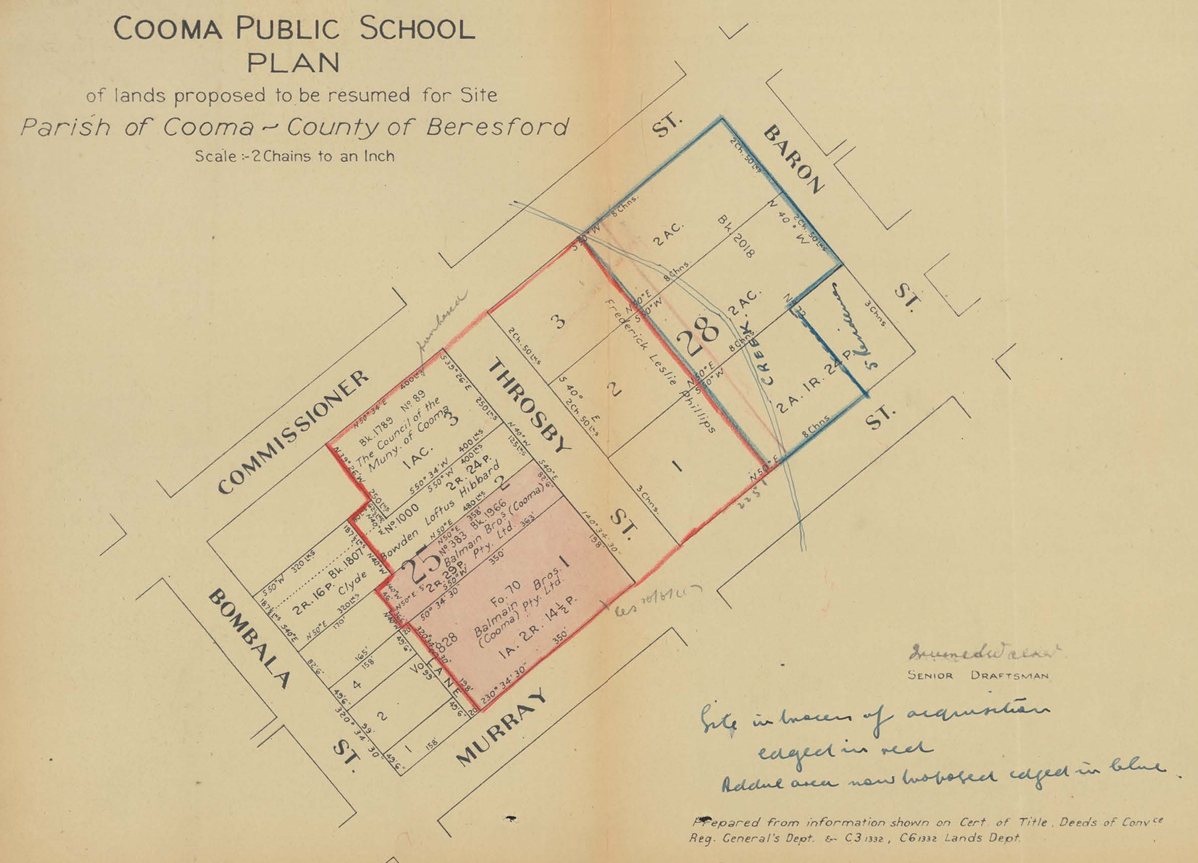
Plans of public buildings
A sample of digitised building plans showing gaols, hospitals, pilot stations, post and telegraph offices, schools and tramways
Related record series list
Building records at NAA
For information on post offices and lighthouses contact the National Archives of Australia.
Pubs & hotel records
Many of the records held for hotels relate to the licensing of publicans and the government's control of the establishment's finances. Consult:
- Publican's Licenses Guide
- our catalogue under the headings Licensing Courts and Licenses Reduction Board
- interim guide to Publicans' licences, available in the Reading Room, for a list of useful sources.
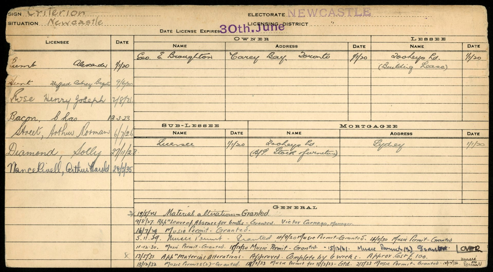
Publicans' licenses guide
The earliest licensing records we hold date from 1798 Bench of Magistrates records. Other early records can be found in the records of the Judge Advocate's Office and the Colonial Secretary
Railway records
The bulk of State Rail's archives collection was transferred to us in 2000. Records include photographs, survey field books, maps and plans and historical notes. Part of this collection is described and listed in our catalogue and the Railways guide.
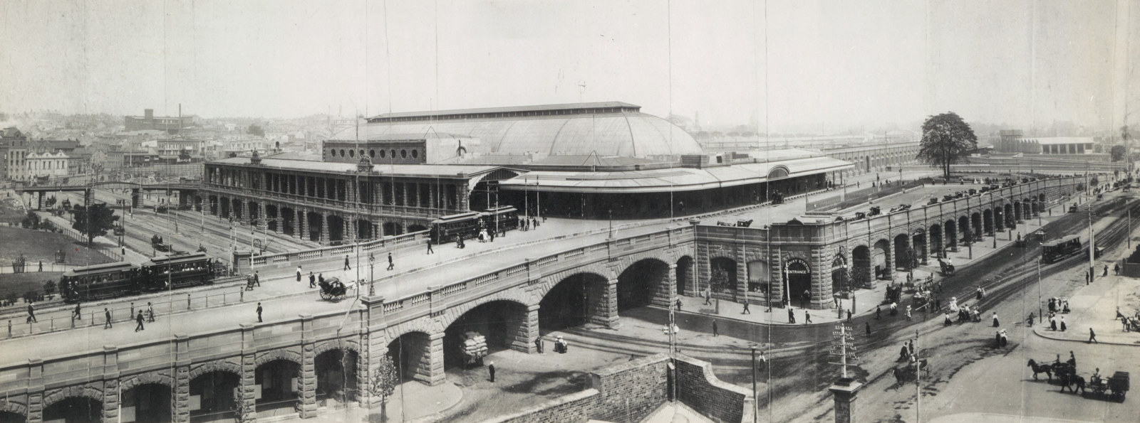
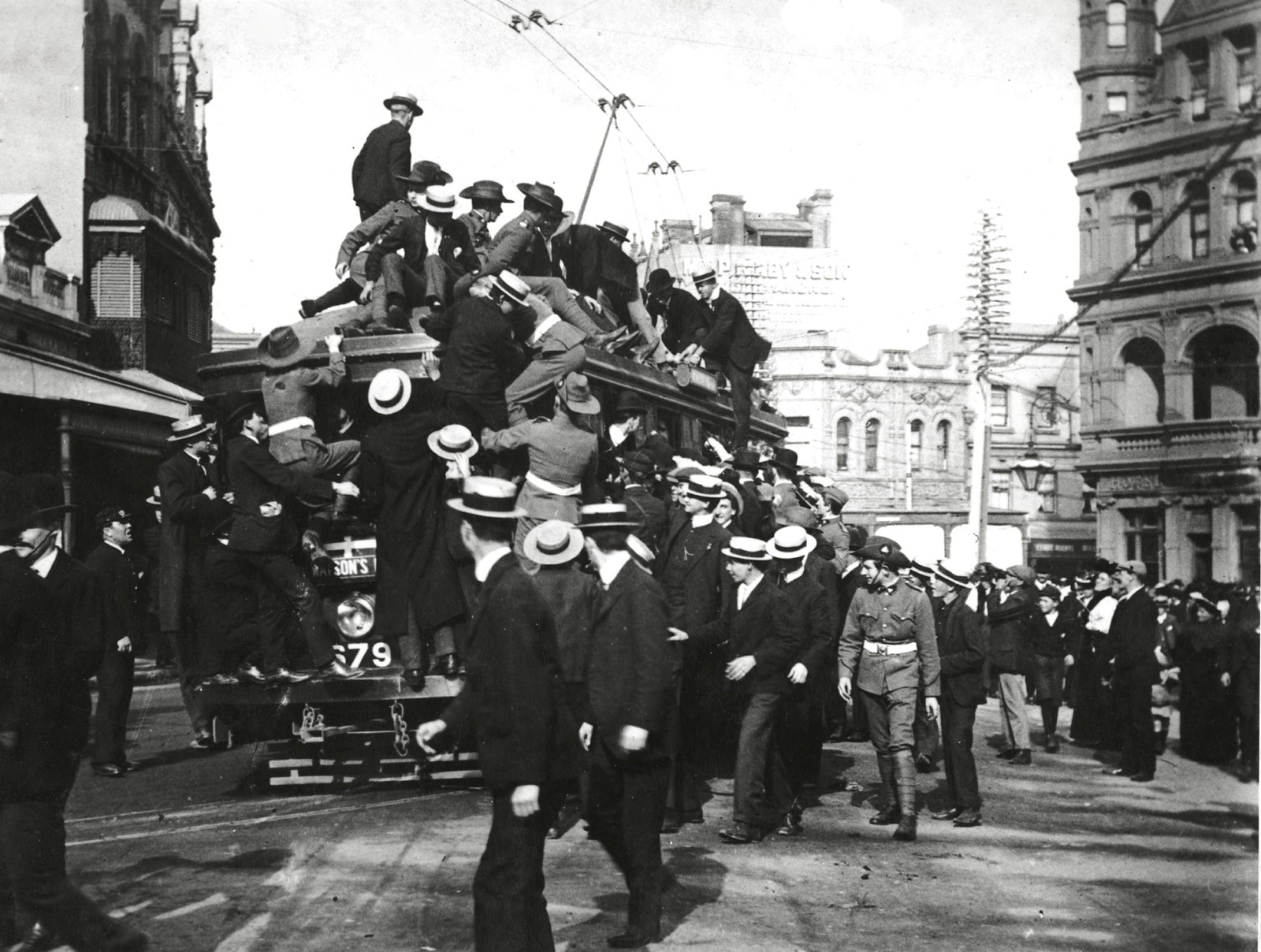
Railway photographs NRS-17420
An introduction to our rich collection of NSW railway photos, including locomotives, carriages, gate houses, railway refreshment rooms, staff and stations
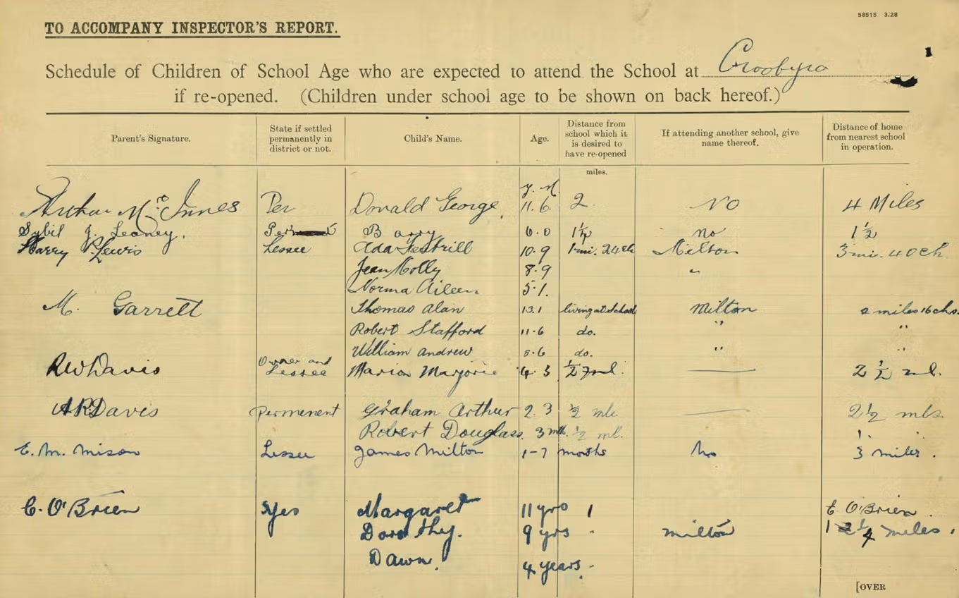
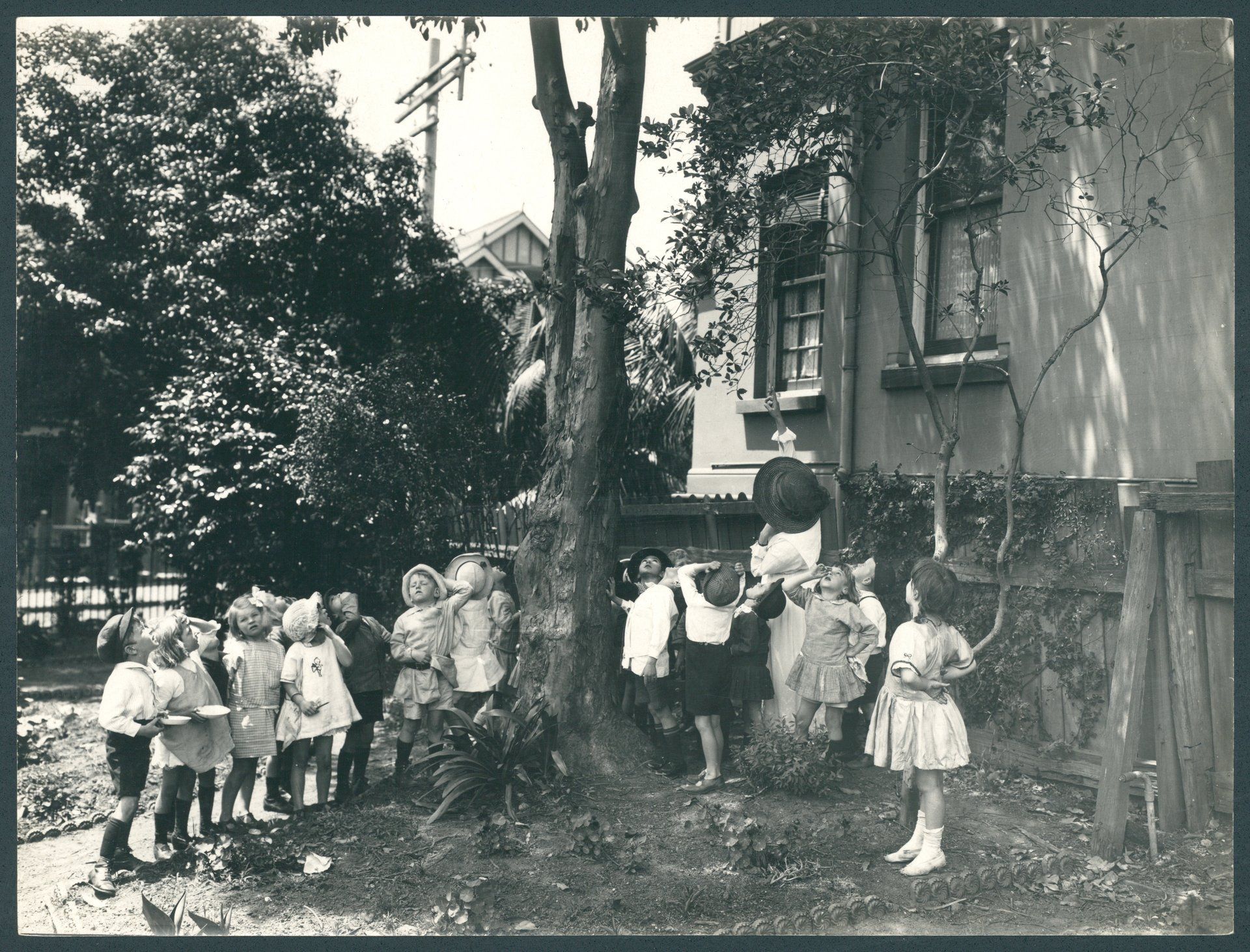
School records
Pre-1848
For records prior to 1848, check our catalogue for records of the Colonial Secretary and the Clergy and School Lands Corporation. The administrative correspondence of the various education authorities (from 1848) provides valuable insight into the development of a locality. See The Administration of Education Under Two Boards, 1848-66 (PDF, 18.5mb); and The Council of Education, 1866-1880 (PDF, 10mb), also available in the Reading Room.
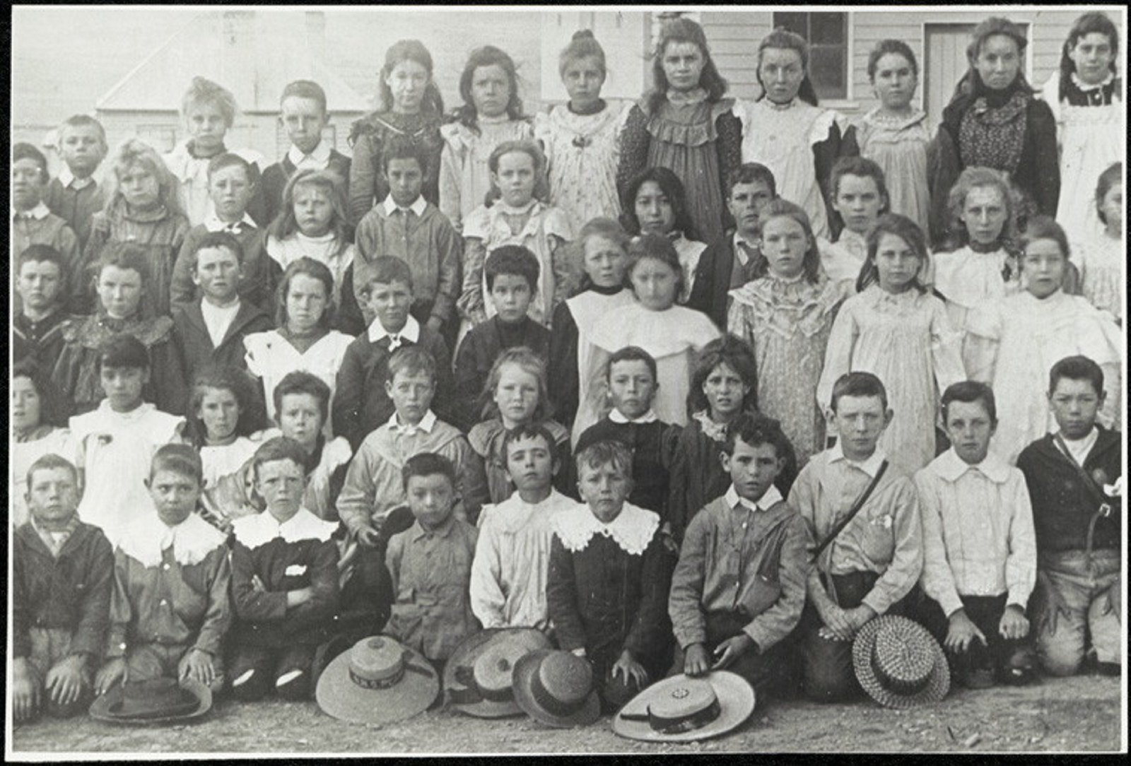
c.1880-c.1979
For the period c.1880-c.1979, consult the following:
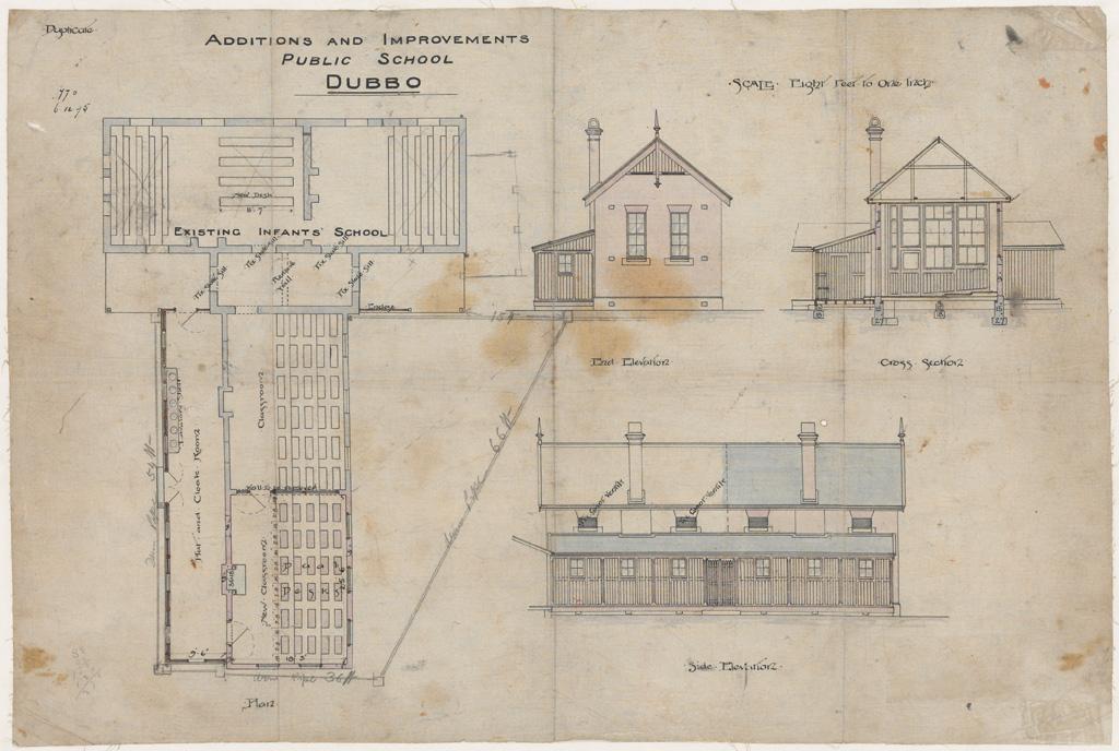
School records guide
An overview of education in New South Wales 1788-c1979 and a list of the main record series
Schools & related index 1876-1979
30,000+ entries include administrative files & records such as admission registers, punishment books & inspection books
Related record series list
The series NRS-15051 Department of Education photographic collection, may also be of interest.
Comparatively few pupil records have survived. Check the School Student Records Guide and with Reading Room staff for details of surviving records.
School student records guide
These records provide information about the admission of children to Government Schools, Orphan Schools and Industrial Schools in NSW.
More records
Maritime records
For records relating to maritime issues consult our catalogue for records of the Public Works Department; Maritime Services Board; Marine Board; Navigation; Sydney Harbour Trust and/or Harbours, Pilots and Lighthouses.
Mining records
We hold a few general registers concerning mining activities. These are generally arranged by locality. For these and other mining records, check our catalogue under Agency 76, Department of Mines, its successors and other relevant public offices.
Public health records
Records covering health issues are listed in the our catalogue under Health. Of note are the NRS 4858 Sanitary Inspection files, 1897-1964, which are arranged by locality.
Roads, water supply, sewerage
For records relating to these amenities consult our catalogue for those created by the Colonial Secretary, the Lands Department and the Department of Public Works.
Records of inhabitants
Many of the records in our collection provide information about the inhabitants of an area. Useful finding aids are the Electoral rolls guide and the Census & musters guide.
Colonial Secretary's records
Individuals are well documented in the Colonial Secretary's correspondence. Start your research with the Colonial Secretary overview guide.
Law enforcement records
NRS 10958 Police Gazettes, 1862-1929, contain entries and photographs of people.
Court records
Court records, depositions and related documents provide a wealth of information about inhabitants of an area. The various court jurisdictions can be found in our catalogue.
See also the Bench of Magistrates Index, 1788-1820 and the Quarter Sessions Indexes (Clerk of the Peace, 1824-1837).
Prison records
Prison records (Agency 1) include, from the 1870s, photographs of prisoners with details of conviction and personal history.
Local history guides
Browse allCounty & parish maps guide
An overview of county, parish and town/village maps created by the Department of Lands and its predecessors
Court of Claims (Land) guide
This court resolved the claims of people who had been promised land grants but were not in possession of the titles, or where the land was in the possession of others claiming to have lawful right to it
Land grants guide, 1788-1856
These records relate to the original alienation of land from the Crown. Parish maps are useful for research in this area, as they record original grants
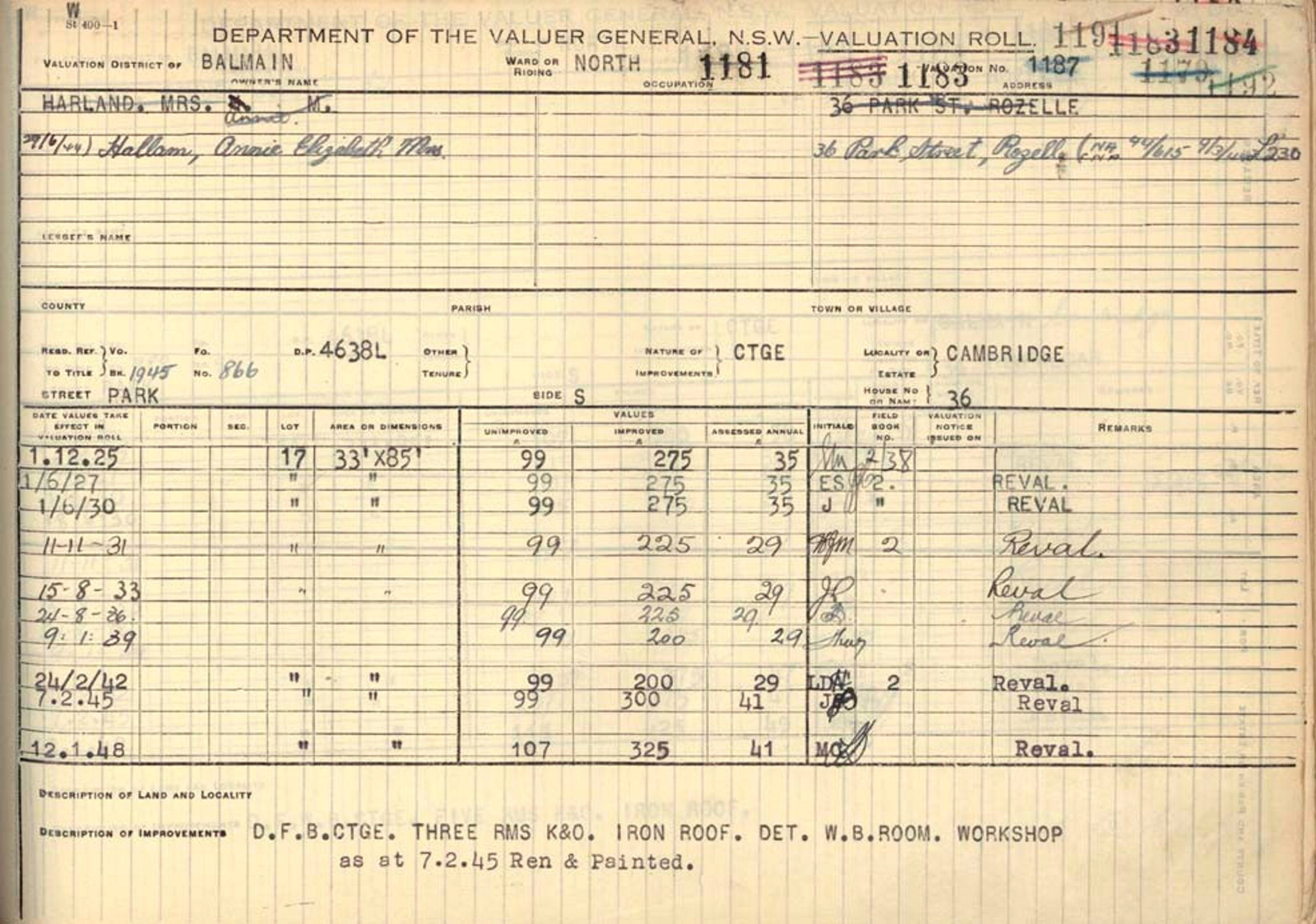
Land valuation guide
Land value refers to the monetary value of the land only and does not include the value of the home or other structures on the land